-
Lake Powell Houseboating
Spring Break 1997
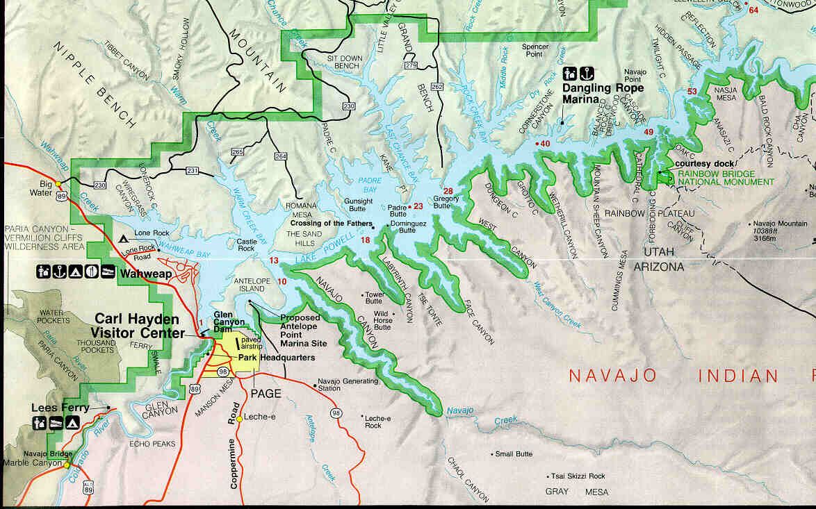
Lake Powell Map and Itinerary
This map reproduced from Glen Canyon Official Map and Guide
National Park Service
U.S. Department of the Interior
GPO 1996 -- 404-952/40067
Last modified: 18 April 1997
Itinerary - Day 1
- Left Wahweap Marina and headed almost due east towards Castle Rock. We thought we would take the "short cut" around castle Rock to River Mile Marker 13 (M13). After rounding Castle Rock we soon discovered that due to the low lake level that route was impassable because it was high-and-dry! We then headed back west and south towards Glen Canyon Dam (M1) and then east around Antelope Island. We took a slight detour into Warm Creek Bay near Marker 13 as we began to figure out how to "read" the buoys. Did just fine until we approach Gregory Butte (M28) where we made the mistake of thinking the larger waterway must be the main river channel. After discovering our mistake and correcting we arrived at Dungeon Canyon (M38) without further navigation incident.
- Day 2
- Spent the entire day in Dungeon Canyon (M38).
- Day 3
- Motored to Dangling Rope Marina (M40).to refuel and decided the worsening weather and forecast for more of the same was enough to send us back to Wahweap Marina and end our Lake Powell experience.
Return to main Lake Powell page.
This map reproduced from Glen Canyon Official Map and Guide
National Park Service
U.S. Department of the Interior
GPO 1996 -- 404-952/40067 - Day 1