Colorado & Utah Vacation

12 - 23 September 2001


Revised 09 October 2001,
Photos & Text © 2001 by Len Schwer

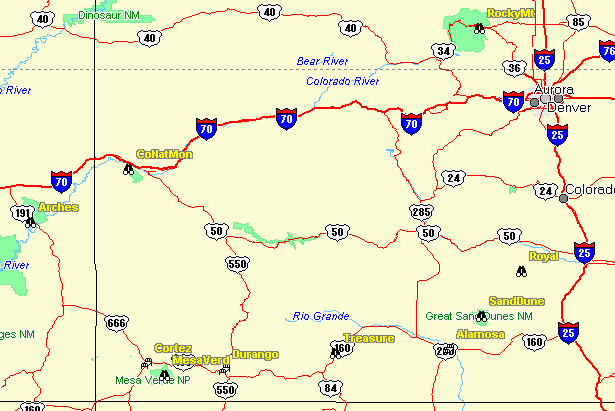
Route of Travel (clockwise) from Colorado Springs to Denver
Map taken from MapSend

  We had planned an 11 day vacation with Ms Becky's parents starting in Colorado Springs with her Dad's annual ship reunion of the World War II crew from the USS Portland. These WWII geezers are a Great bunch of guys and I very much enjoy talking with them and listening to their conversations.

  The planned start of our trip was 13 Sep, but the World Trade Center tragedy cancelled our departing flight plans, so we rented a car and drove 1,350 miles from Windsor CA to Colorado Springs in three days. We had plenty of rental car company all along I-80 as that was the current mode of transportation of choice.

  We arrived in COS on 14 Sep Friday, in the early afternoon, and meet Becky's parents who had planned to drive and arrived a day early. The only reunion event we missed was the Memorial Ceremony at the Air Force Chapel, as the Air Force Academy was closed to visitors.

  The remainder of our vacation went as planned and we had wonderful weather for the entire trip. Our timing for the fall colors was near perfect as the aspens were a brilliant yellow which contrasted very nicely with the dark green of the conifer covered mountains.

Click on a picture to size full size view in floating window.

Pike's Peak & Cog Railway
  While staying in Colorado Springs we took a trip to Pike's Peak at 14,110 feet via the Cog Railway. This was well worth doing as the scenery on the way up/down was great as were the views from atop Pikes Peak.
  I took a picture of Pike's Peak from the window of our room at the Radisson Hotel near the Air Force Academy. The Cog Rail station is at an elevation of 6,751 feet so the rail only goes up 7,356 feet, about 1.4 miles, with the steepest grades about 20%. This is the highest cog railway in the world. The modern diesel engines are Swiss made, but I assume the old steam engines were made in the USA. The cogs on the train run between a pair of narrow gauge rails and provide both positive traction and braking.
  The summit is typically about 30 degrees cooler than the temperature at the station, which was mid-60's when we departed in the morning. There were still small patches of snow in the shadows at the summit. On a clear day, and we had a fairly clear day, they say you can see all the way to Kansas, but who can tell where the billiard table flat eastern view changes from Colorado to Kansas?
  The camera cannot due justice to the beautiful scenery, but above the tree line at about 11,000 feet it becomes obvious why these mountains are called the Rocky Mountains as there is nothing but rocks. So maybe it's time to nod off for a bit of a rest on the smooth ride down the mountain.
FromHotel.jpg StationSign.jpg RayBecky.jpg
OldEngine.jpg ModernEngine.jpg CogGear.jpg
NormaRay.jpg InsideCar.jpg Siding.jpg
BeckyPeak.jpg RayNorma.jpg BeckyLen.jpg
BeckyCar.jpg Becky.jpg BeckyView.jpg
EasternView.jpg ViewDown.jpg ViewDownB.jpg
NormaNoding.jpg

Royal Gorge
  Departed Colorado Springs for Canon City to visit the Royal Gorge and bridge. The world's highest suspension bridge at 1,053 feet above the Arkansas River. Surprisingly, this is a private attraction and not a state or national facility.
  This is a worthwhile stop as for $16 admission you get to ride the aerial tram across the gorge, walk across the bridge, ride the 100% grade incline railway, and view a 12 minute presentation on the history of the gorge and construction of its various modes of transportation.
  I found the clock at the entrance to be interesting as in addition to the hour and minutes it displays the year, month, and day. Riding the tram across the canyon provides some nice views. The inclined railway was a very interesting ride, and an easy way to reach the bottom of the canyon and view the underside of the bridge.
  Of engineering interest is the so called 'hanging bridge' along the river. To allow passage of the railroad tracks in this very steep and narrow portion of the canyon, they built an A-frame across the canyon and suspended the track from this structure.
RayBeckyNorma.jpg Bridge.jpg BridgeB.jpg
TracksRiver.jpg InclineCars.jpg BridgeBelow.jpg
HangingBridge.jpg

Great Sand Dunes National Monument
  En route from Canyon City and the Royal Gorge to Alamosa, we stopped at the Great Sand Dunes National Monument outside of Alamosa. Interesting pile of sand, but too far out of the way to recommend.
  The weather was threatening rain, although it did not rain. I thought the lighting on the dunes was interesting and tried to capture some of the light and shadow play on the dunes.
  We stayed the night at the Holiday Inn in Alamosa which is a nice facility.
Welcome.jpg View-A.jpg View-B.jpg
NormaBecky.jpg NormaBeckyClose.jpg

Durango & Silverton
  On the drive from Alamosa to Durango we stopped to view Treasure Falls. Which provided a nice view, although the water flow is quite low in September, but the nearby rest facilities were also a good reason to stop.
  The steam train from Durango to Silverton is a very interesting train experience. The scenery is fantastic, especially in early fall when the aspens are turning bright yellow.
  We traveled with Engine 481 on the third (final) departure from Durango. I took some pictures of Engine 480 while we waited at the Durango station.
  We opted for the extra expense of the parlor car (Alamosa) and recommend it as the seating is quit comfortable with small tables for 2 or 4 people.
But the opportunity to stand outside on the end of the car and take in the views made it very worthwhile for me. My favorite picture of the trip was taken from the end of the parlor car as we passed through a grove of aspens; see the third row center.
  We had lunch in Silverton at Handlebars Saloon which was recommended by our parlor car hostess Maylyn. The views of the aspen covered mountains surrounding Silverton were great, although in these pictures they look like hills covered with yellow wild flowers.
  The trip is a bit too long, especially the last hour of the return to Durango where the scenery is now relatively bland.
Falls.jpg BeckyNormaRay.jpg Alamosa.jpg
Engine480.jpg Engine480-B.jpg BeckyRayNorma-B.jpg
Curve.jpg RearView.jpg Scenery.jpg
Silverton.jpg SilvertonB.jpg Scenery-B.jpg
Engine481.jpg Engine481-B.jpg Engine481-C.jpg
PassengerCars.jpg RiverView.jpg Curve-B.jpg

Mesa Verde
  It is a relatively short drive (36 miles) from Durango to the entrance to Mesa Verde. Then another 15 mile drive from the entrance to the Mesa Verde visitor center. A drive thorough tour of the park takes a minimum of about 4 hours. The only dwellings you can observe close-up are at Spruce Tree House. The other two sites require ranger guides and some ladder and tunnel climbing.   I think the similar ruins in Arizona, especially in Canyon de Chelly, are probably on an equal footing with MV, but those sites are much less crowded.
  Pictured are Spruce House in the first five pictures, Oak Tree House and its overlooking canyon, and finally Balcony House.
SpruceHouse.jpg SpruceHouse-C.jpg Becky.jpg
Ruins.jpg CermonialPit.jpg Ruins-C.jpg
BeckyLen.jpg Canyon.jpg BalconyHouse-B.jpg

Arches National Park
  This park is just north of Moab Utah on US Highway 191 not too far south of Interstate I-70. To see most of the arches you need to take short (0.3 miles one way) or long hikes (>1 mile). We did a few short hikes to see the arches at the northern end of the park. The temperature was in the mid-80s and taking water along on the hike is a must; I would not want to hike at mid-day here in the summer months.
  Sand Dune arc is probably the most accessible after a 0.2 mile hike and you can walk under the arch too. Pictured below are Skyline Arch, Broken Arch (twice), and Sand Dune in the center of the second row. Look closely for Becky in the Broken Arch pictures.
  En route from Cortez we skipped the nearby Natural Bridges Park as it is further from the highway and we figured the formations would be similar to those at Natural Bridges. The red rock formations in the vicinty of the Four Corners area are quite similar.
Skyline.jpg Broken.jpg Broken-B.jpg
BeckyLen-B.jpg SandDunes.jpg BeckyLen.jpg
Becky.jpg

Colorado National Monument
  The Colorado National Monument offers a scenic drive that is only a few miles south of I-70 near Fruita and Grand Junction. The main attraction is a tall rock spire in the center of a large canyon. Apparently rock climbers had placed an American flag at the top of the spire after the 11 Sep WTC attack.
  I thought some of the twisted tress were interesting. They reminded me of the Bristle Cone Pine trees near Bishop CA.
  I learned the difference between a National Monument and a National Park is the former is established by the President and features a single attraction, while the latter is established by Congress and offer multiple attractions and uses.
Monument.jpg LenBecky.jpg NormaBecky.jpg
Tree-B.jpg Tree.jpg Tree-C.jpg
Canyon.jpg BeckyRayNorma.jpg

Rocky Mountain National Park
  Rocky Mountain National Park is also very scenic and claims the country's highest paved highway US 34 with a maximum altitude of 12,183 feet. The pictured Alpine Visitor Center is at an altitude of about 11,000 feet. The panoramic views of the surrounding valleys are wonderful.
  There are also a large number of elk in the park and the meadow at the east end of the park is a prime viewing location in early evening. The spot is so popular that vehicle gridlock is only avoided by the efforts of several park
rangers attempting to accommodate those wishing to pull to the side of the road for a view of the elk and those attempting to drive thru the traffic maze. (I was driving and thus I have no elk pictures.)
  We overnighted in Estes Park on a Saturday night. I do not know if this small town is only crowed on weekends, but the 3-5 block downtown section is near gridlock with long lines of vehicles waiting on the feeder roads to enter the downtown region. Perhaps a place to be visited only on week days?
Alpine.jpg NormaRayBecky.jpg View.jpg

Return to Len Schwer's home page


Photos & Text © 2001 by Len Schwer